Kumrat Valley

National Tourism Portal

AttractionType

Valley, Lake

National Tourism Portal

District

Upper Dir

City

Wari

National Tourism Portal National Tourism Portal National Tourism Portal National Tourism Portal National Tourism Portal
   Photo Credit:
    Muhammad Ibrahim

Attraction Type

Valley
Lake

Description

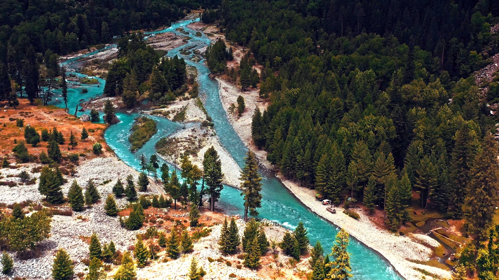
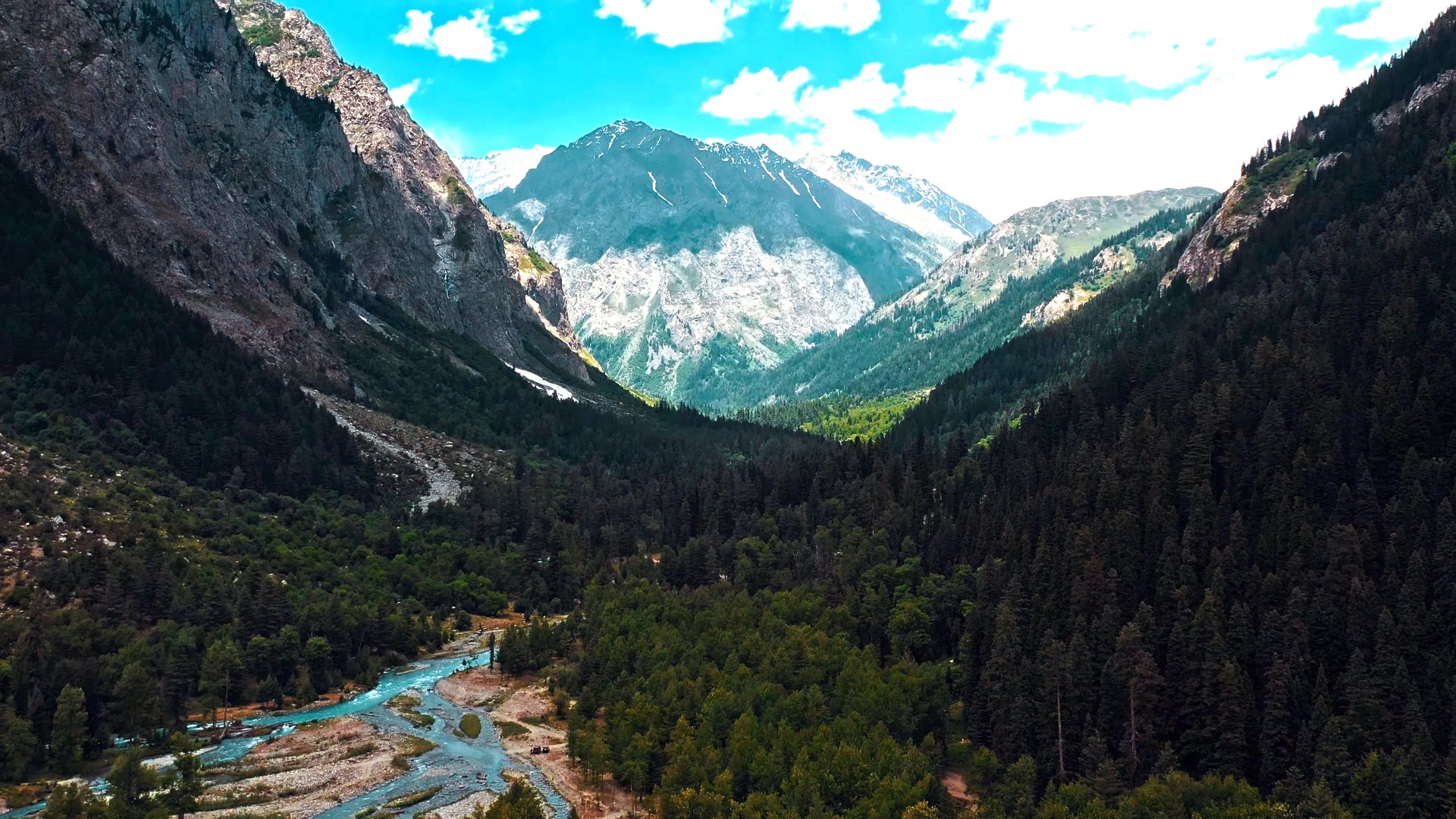
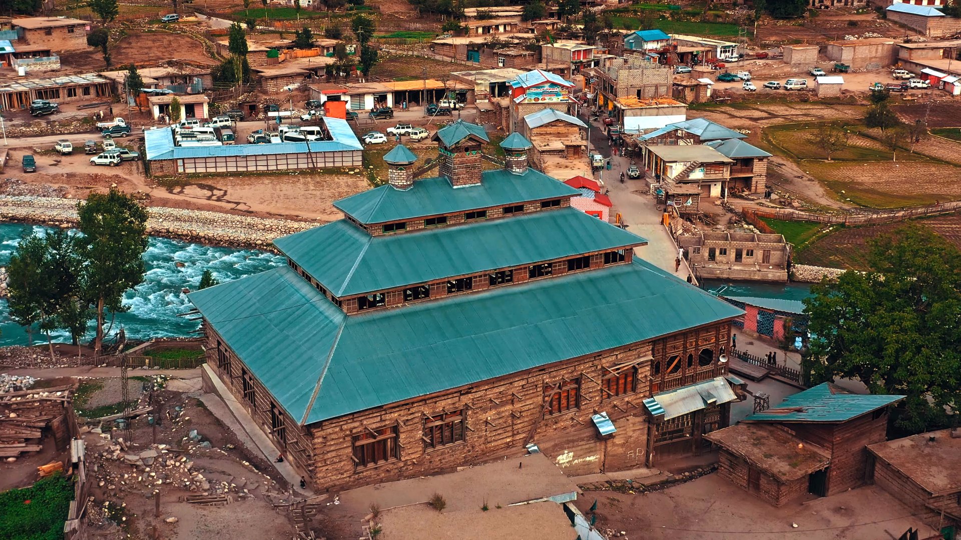
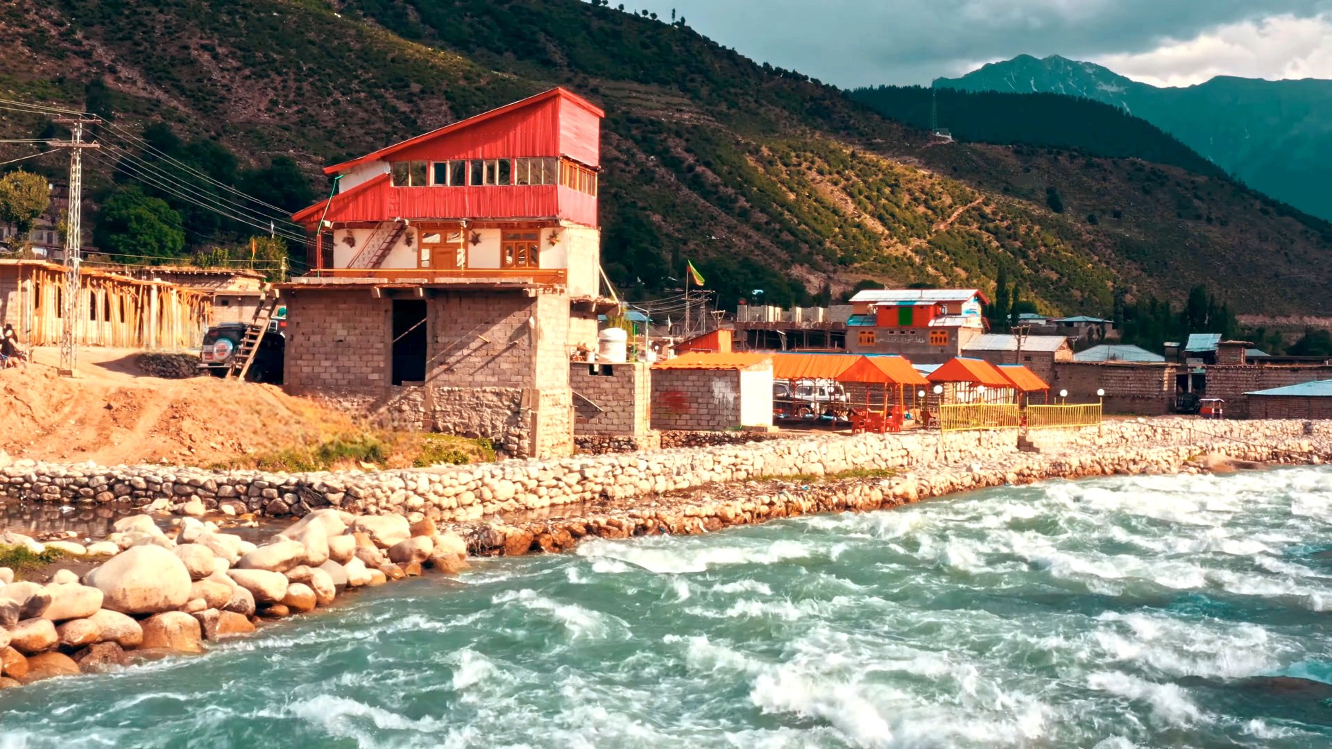
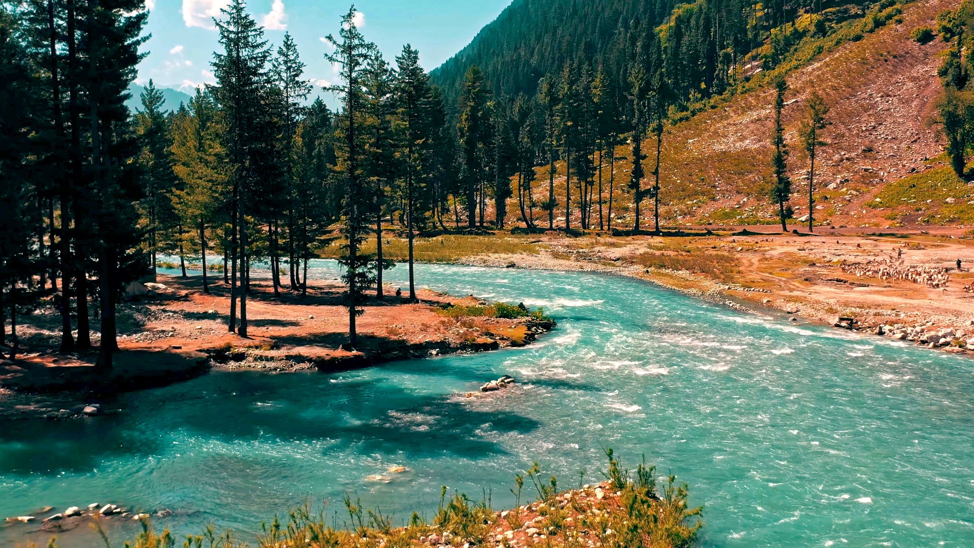
Kumrat Valley, a pristine alpine valley at 2,400-3,100 meters (7,800-10,170 feet) in Upper Dir District, Khyber Pakhtunkhwa, Pakistan, is a haven of deodar forests, snow-capped Hindu Raj peaks, and the Panjkora River. Known for its lush meadows, waterfalls, and attractions like Jahaz Banda and Katora Lake, it draws adventurers and nature lovers. Local folklore, such as tales of Prince Kumrat, adds cultural depth. Rampant commercialization and littering threaten its raw beauty, but Pashtun hospitality and unspoiled landscapes make it a must-visit.

National Tourism Portal

What To Do

  • Trekking to Jahaz Banda Meadows and Katora Lake
  • Camping along the Panjkora River or at Jahaz Banda
  • Fishing for snow trout in the Panjkora River (permit required)
  • Visiting Kumrat Waterfall for swimming and photography
  • Exploring Kala Chashma (Black Spring) for its dark stone springs
  • Jeep safaris through rugged trails to Dojanga or Chahrot Banda
  • Hiking to Badgoi Pass for views of Swat and Upper Dir
  • Photography of deodar forests, snow-capped peaks, and wooden canals
  • Engaging with Pashtun culture through local festivals and cuisine
  • Birdwatching for monal pheasants and other high-altitude species

What To Buy

National Tourism Portal

What is Around

  • Panjkora River, ideal for fishing and riverside camping
  • Kumrat Waterfall, a refreshing spot for picnics and photos
  • Jahaz Banda Meadows, a lush trekking destination at 3,100m
  • Kala Chashma (Black Spring), a unique spring with dark stones
  • Deodar forests, home to snow leopards and monal pheasants
  • Wooden canals in Thal, showcasing traditional irrigation
  • Thal Bazaar, a market for snacks and trekking supplies
  • Dojanga, a scenic spot with meadows and streams
  • Jandrai village, a base for treks with cultural insights
  • Badgoi Pass, connecting Kumrat to Kalam with panoramic views

Nearby Tourist

  • Katora Lake (21.8 km, via trek): A turquoise alpine lake at 3,500m.
  • Jahaz Banda Meadows (21.6 km): A high-altitude meadow for camping.
  • Kumrat Waterfall (1.4 km): A cascading waterfall in the valley.
  • Kalam Valley (63 km): A hill station with Mahodand Lake.
  • Kundol Lake (51 km, via Utror): A glacial lake in Swat Valley.
  • Panjkora River (142 m): A fishing and scenic spot throughout the valley.
National Tourism Portal

Best Season to visit

August
July
June
May
October
September

Spring (May)

  • Spring offers cool temperatures (10-20°C) and blooming wildflowers, ideal for trekking to Jahaz Banda and photography. Roads are accessible but may be muddy; use a 4x4 jeep. Pack waterproof gear and check for occasional rain. Crowds are minimal.

Summer (June - August)

  • Summer is the peak season with pleasant days (15-25°C) and cold nights (5-10°C), perfect for camping, fishing, and jeep safaris. Monsoons (July-August) bring heavy rain (255 mm monthly), causing road blockages; expect crowds. Carry rain gear and book early.

Autumn (September - October)

  • Autumn provides mild temperatures (10-20°C) and clear skies, great for hiking and stargazing with fewer tourists. Trails are stable, but nights are cold; pack warm clothing. Vibrant foliage enhances photography.

Winter (November - April)

  • Winter brings heavy snowfall (-16 to 0°C) and road closures, making the valley inaccessible except for experienced trekkers with specialized gear. The valley transforms into a snowy wonderland, but facilities are limited; not recommended for casual visitors.
National Tourism Portal

How to Reach


  • By Air: Fly into Islamabad International Airport (ISB) from major cities (e.g., Karachi: 2 hours, Lahore: 1 hour). From Islamabad, hire a taxi to Thal via M-1, Swat Expressway, and Upper Dir (377 km, 8-10 hours). From Thal, take a 4x4 jeep to Kumrat Valley (7.6 km, 50-60 minutes). Use “Kumrat Valley” as the destination. Alternatively, fly to Chitral (1 hour) and drive to Thal (6-7 hours).
  • By Road from Major Cities:
    • From Islamabad: Drive via M-1, Swat Expressway, Chakdara, and Sheringal to Thal (363 km, 8-10 hours), then a jeep to Kumrat (7.6 km, 50-60 minutes). Use a 4x4 for unpaved roads.
    • From Lahore: Take M-2 to Islamabad, then Swat Expressway to Thal (696 km, 12-14 hours), then a jeep to Kumrat.
    • From Karachi: Use M-9 and N-25 to Islamabad, then Swat Expressway to Thal (1,691 km, 25-26 hours), then a jeep to Kumrat. Avoid monsoon travel due to landslides.
  • By Train: No direct rail access. Travel to Rawalpindi Railway Station (from Lahore: 4-5 hours, Karachi: 24 hours) via trains like the Khyber Mail, then take a taxi to Islamabad (30 minutes). From Islamabad, follow the road route to Thal and Kumrat (8-10 hours). Check Pakistan Railways’ schedules.
  • By Public Transport: From Islamabad, take a Daewoo or Faisal Movers bus to Dir Upper via Chakdara (8-10 hours). From Dir, take a local hiace to Thal (2 hours). From Thal, hire a 4x4 jeep to Kumrat Valley (50-60 hours). Alternatively, from Swat (Kalam), hire a jeep via Badgoi Pass (3 hours). Book in advance; carry cash.
National Tourism Portal

Where to Eat / Stay

Where to Eat:

  • No permanent restaurants exist in Kumrat Valley. Chai huts and tuck shops in Thal Bazaar and along the Panjkora River offer tea, snacks, and basic meals like naan and daal. Bring high-energy snacks (e.g., nuts, dried fruits) for treks and avoid single-use plastics to reduce littering, a major issue. Dir and Chakdara bazaars provide Pakistani dishes like biryani and karahi.

Where to Stay:

  • Camping is popular along the Panjkora River or Jahaz Banda (rent tents in Thal). Guesthouses and wooden cabins in Kumrat and Thal offer basic rooms. Dir and Kalam have budget hotels. For bookings, explore luxury, budget hotels, and guest houses through the booking section of the National Tourism Portal.
National Tourism Portal

Emergency Contact Numbers


  • Hospitals:
    • District Headquarters Hospital Dir Upper: (44 km from Kumrat)
    • Civil Hospital Thal:  (7.5 km, limited facilities)
  • Ambulances:
    • Rescue 1122: 1122 (Dir region, limited coverage)
    • Edhi Ambulance Service: 115 (Dir-based)
  • Police Station:
    • Thal Police Station: (7.5 km)
    • Emergency Police Helpline: 15
  • Rescue Services: Contact Rescue 1122 for emergencies; no helicopter rescue available. Note: Verify numbers before visiting, as connectivity is limited beyond Thal. Use a Zong SIM and register at Thal check post. Carry a first aid kit and altitude sickness medication for treks.

National Tourism Portal

Location on Google Map

National Tourism Portal

Youtube Video